
Send Data, Get Results
One analysis, one map set, one database — clear scope, fixed price.
- Spatial analysis & thematic maps
- Digitising, conversion & data cleaning
- Satellite imagery processing
Your geospatial delivery partner from Semarang City, Central Java: spatial analysis, data processing, remote sensing, survey & mapping with our field partners, through to WebGIS, Geoportals, and Digital Twins. Mitra pekerjaan geospasial Anda dari Kota Semarang, Jawa Tengah: analisis spasial, pengolahan data, penginderaan jauh, survei pemetaan bersama mitra lapangan, hingga WebGIS, Geoportal, dan Digital Twin.
Hand over part of the work — one analysis, one map set, one system — or a complete turnkey project from field survey to web platform. We are also ready to be the GIS team behind consultants, contractors, and agencies running a project. Serahkan sebagian pekerjaan — satu analisis, satu set peta, satu sistem — atau terima beres satu proyek penuh dari survei lapangan sampai platform web. Kami juga siap menjadi tim GIS di belakang konsultan, kontraktor, dan instansi yang sedang memegang proyek.
POWERED BY MODERN TECHNOLOGY DIDUKUNG OLEH TEKNOLOGI MODERN
Pick one service or combine several — from data processing to a ready-to-use system.
We build custom, standalone, and responsive web mapping platforms (WebGIS) focused on real functionality without overloading your server architecture.
Learn more →Send us your question and your data — we run the analysis, from land suitability and disaster risk to site selection, delivered with thematic maps, tables, and a defensible method write-up.
Learn more →
From paper maps, CAD drawings, and spreadsheets to scattered survey data — we turn it into clean, consistent GIS data ready for analysis, printing, or display in a WebGIS.
Monitor large areas without visiting every corner: land cover, year-to-year change, vegetation condition, and flood extent — processed from satellite imagery with clear accuracy assessment.
Learn more →Need field data and its processing in one go? We coordinate surveys with our field partners, then process the data ourselves into maps, 3D models, analysis, or a WebGIS — you deal with a single point of contact.
Learn more →For consultants, contractors, agencies, and companies running a project: we become the geospatial team behind you — handling data processing, analysis, maps, WebGIS, geoportals, and digital twins on your project timeline.
Learn more →Manage and publish large-scale spatial data through interoperable, OGC-standard geoportals (WMS/WFS/WMTS) ready to connect with other systems.
Learn more →Build an accurate 3D digital twin of your city or area — combining city models, photogrammetry, and point clouds in a single web platform.
Learn more →Our BNSP/Kemnaker training & certification portal runs on its own site: training.geoanfaspasial.com.
Whatever the geospatial job — choose the engagement that fits your project best.
One analysis, one map set, one database — clear scope, fixed price.
For consultants, contractors, and agencies short of hands before a deadline.
Terrestrial, aerial, and remote-sensing surveys with our partners — then processed by us to completion.
Examples of what is requested most. Not on the list? Tell us your question — we will propose the method.
Explore various geographic information systems and spatial portals we have developed. Jelajahi berbagai sistem informasi geografis dan portal tata ruang yang telah kami kembangkan.


Built by Geo Anfa Spasial: LiDAR point clouds + drone photos into textured LoD2 building models in 6 modules — AI footprints, watertight reconstruction, real-photo textures, through to CesiumJS-ready 3D Tiles & CityJSON. Tested on real data: 0.24 m roof RMSE. Swipe the images to see the app, or click the title to read the case study. Aplikasi buatan Geo Anfa Spasial: point cloud LiDAR + foto drone menjadi model 3D bangunan LoD2 bertekstur dalam 6 modul — footprint AI, rekonstruksi watertight, tekstur foto asli, hingga 3D Tiles & CityJSON siap CesiumJS. Diuji pada data nyata: RMSE atap 0,24 m. Geser gambar untuk melihat aplikasinya, atau klik judul untuk membaca studi kasusnya.

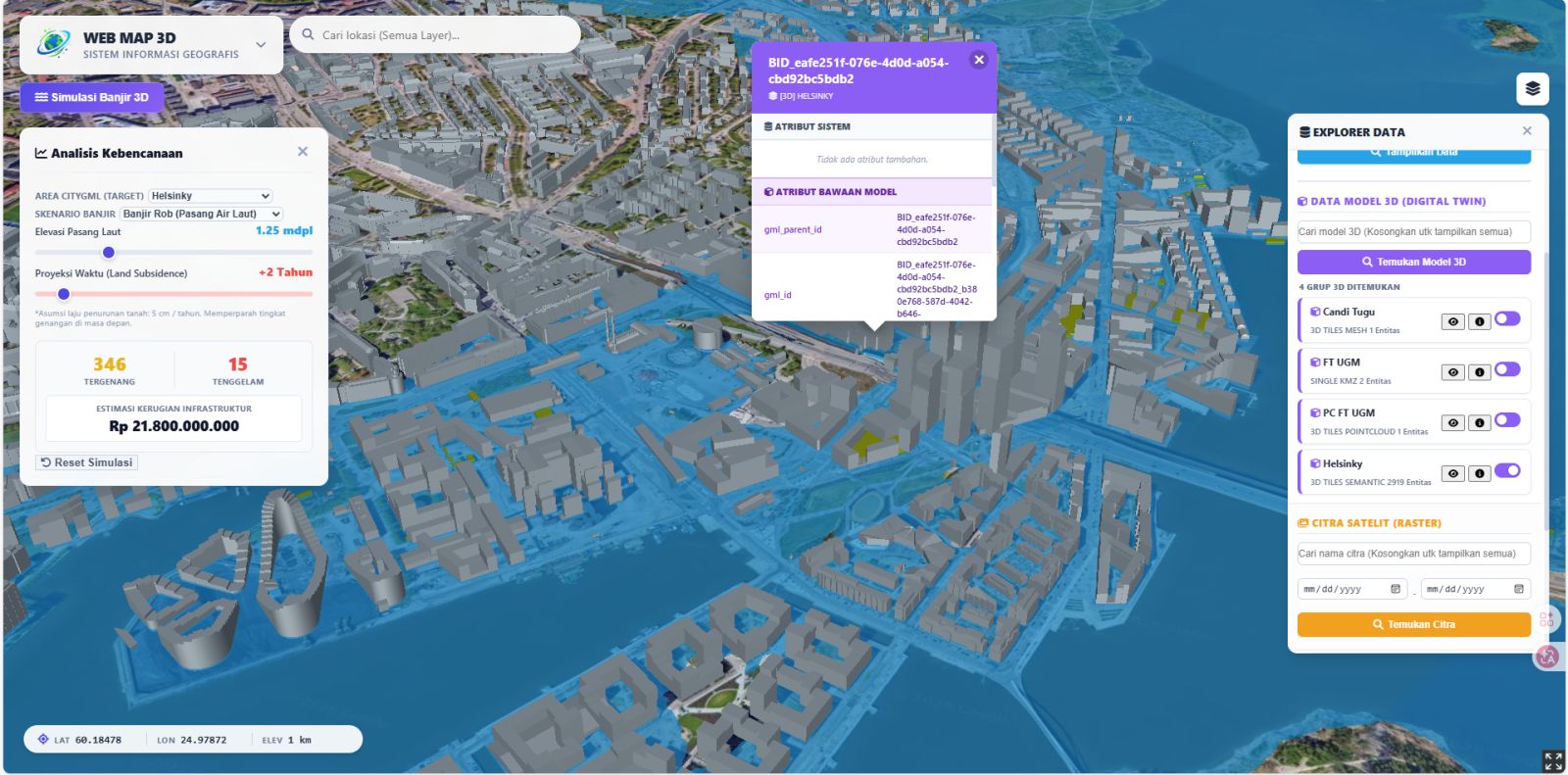
Advanced Digital Twin combining CityGML/CityJSON with 3D Tiles (photogrammetry, point clouds) and individual 3D models (GLB/KMZ). Demo features Kalasatama, Helsinki. Ready to be your Digital Twin partner. Click the image to play the video, or the title to read the case study. Prototipe Digital Twin memadukan CityGML/CityJSON dengan 3D Tiles (fotogrametri, point cloud) serta model 3D satuan (GLB/KMZ). Demo menggunakan data Kalasatama, Helsinki. Siap menjadi mitra Digital Twin Anda. Klik gambar untuk memutar video, atau klik judul untuk membaca studi kasusnya.
Open live demo
OGC standard WebGIS system (WMS/WFS) for massive spatial data & time-series raster management. Click the card to play the demo video, or the title to read the case study. Sistem WebGIS berskala Geoportal standar OGC (WMS/WFS) untuk manajemen data spasial masif & raster time-series. Klik kartu untuk memutar video demonstrasi, atau klik judul untuk membaca studi kasusnya.


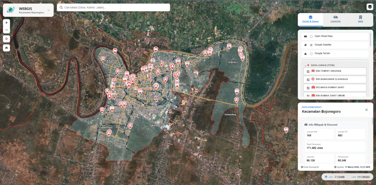
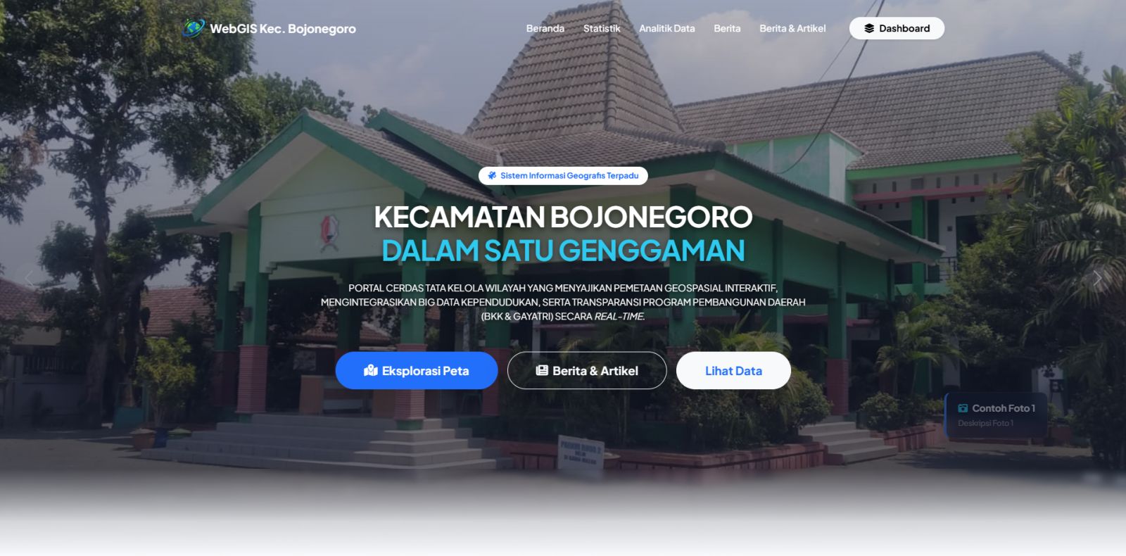
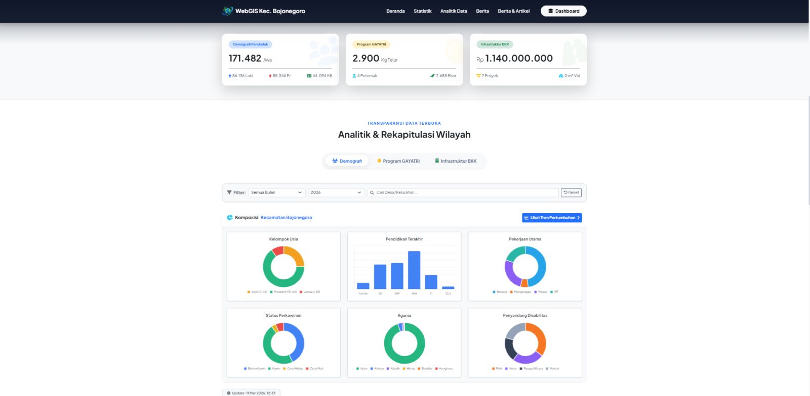
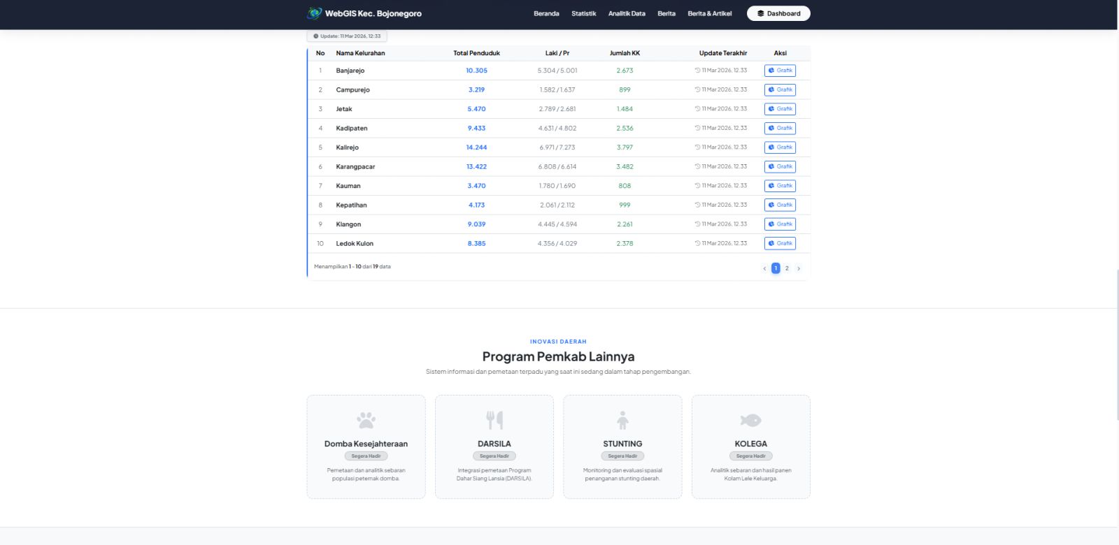
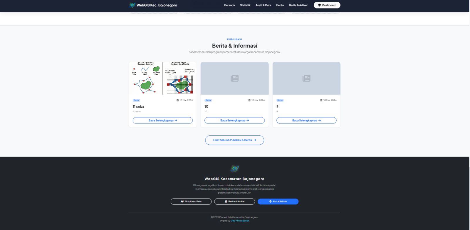
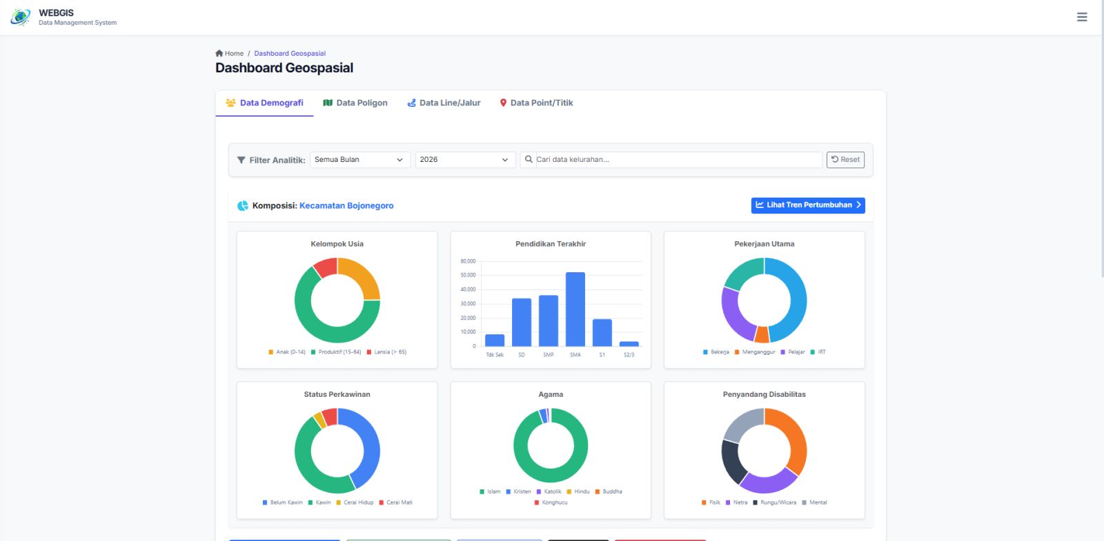
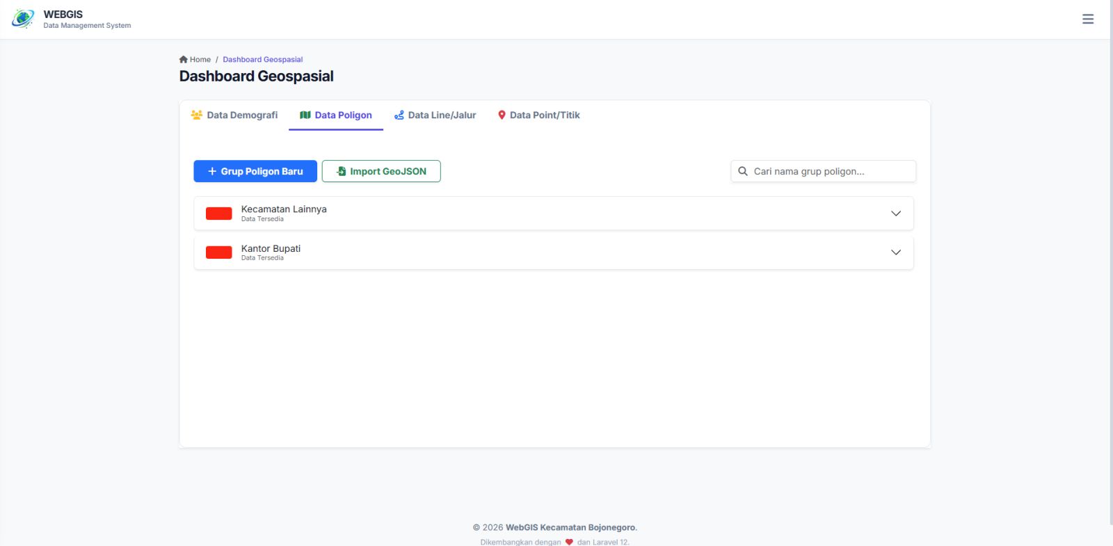
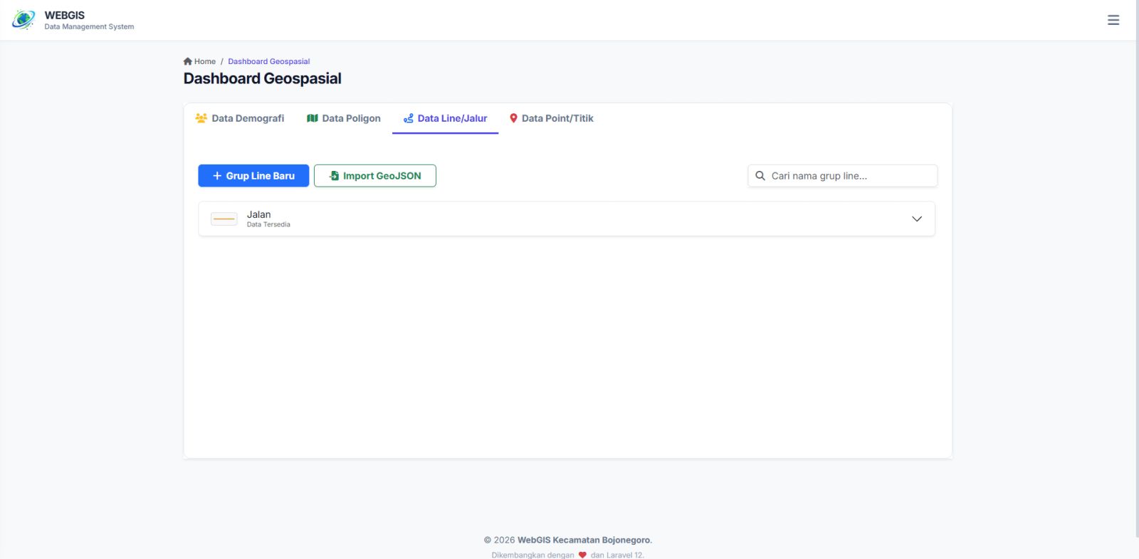
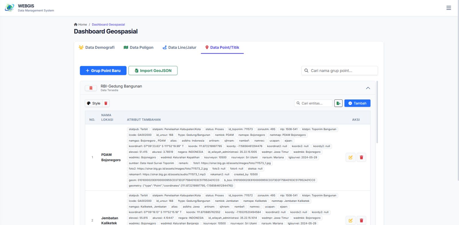
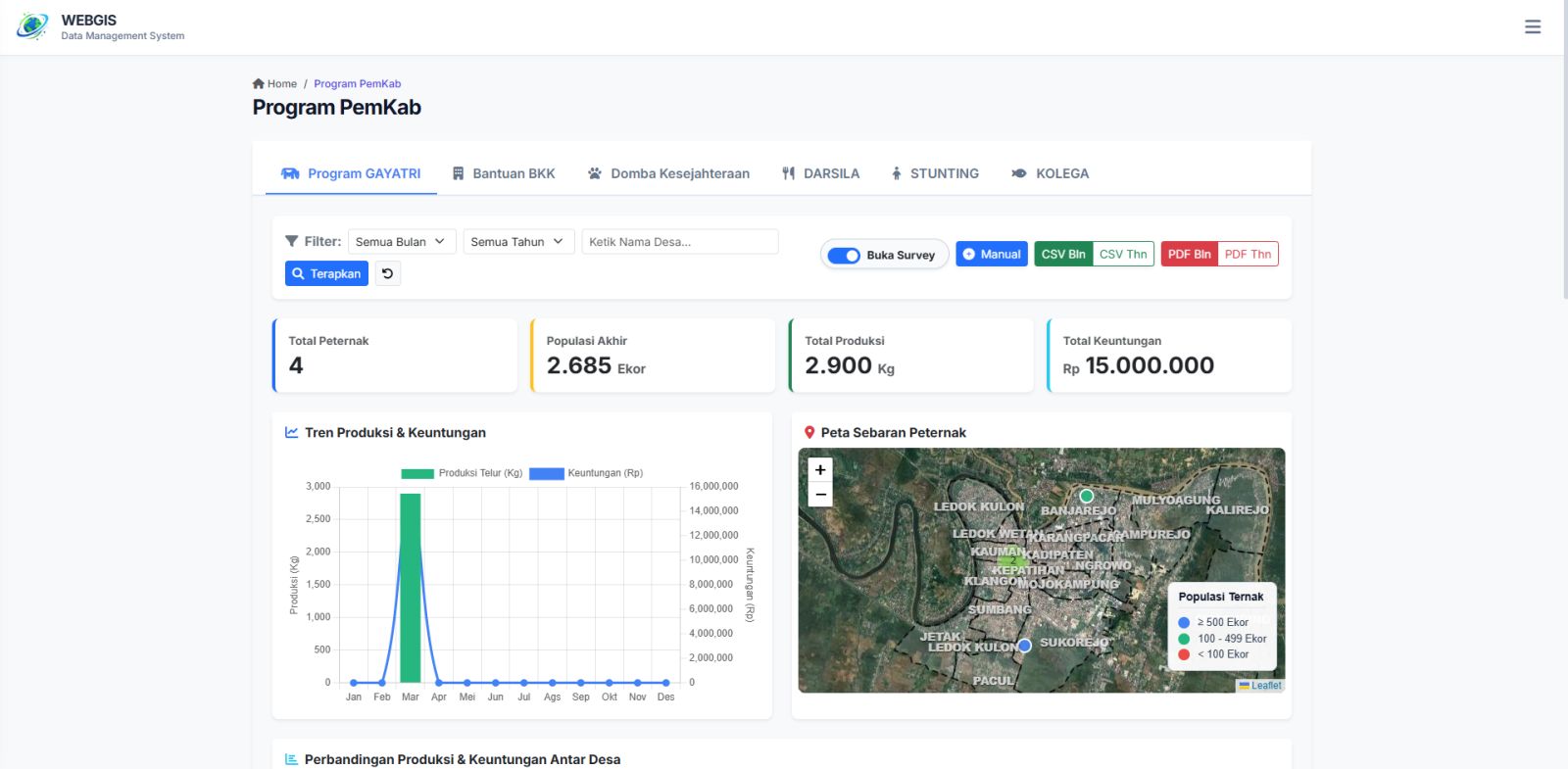
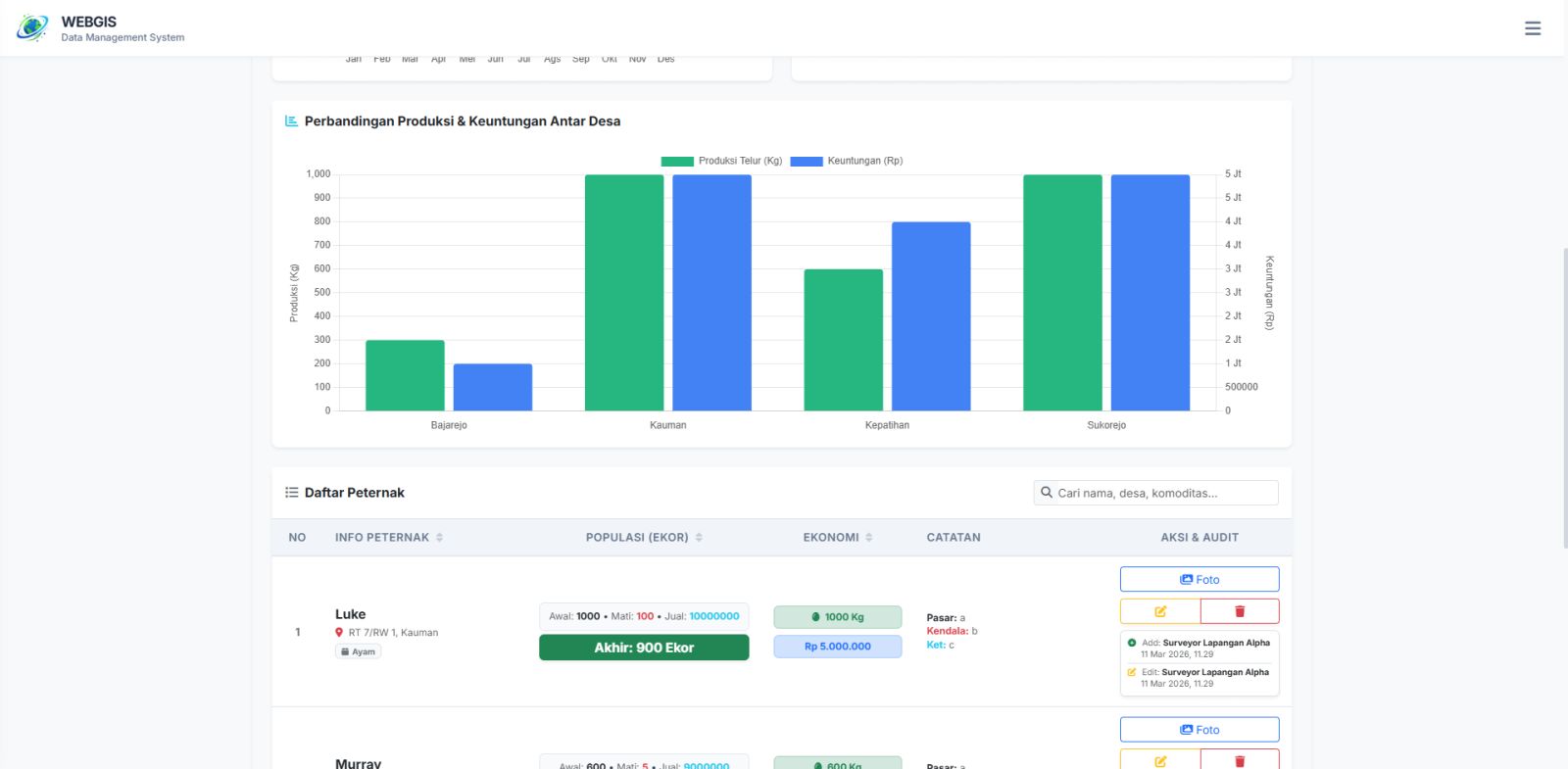
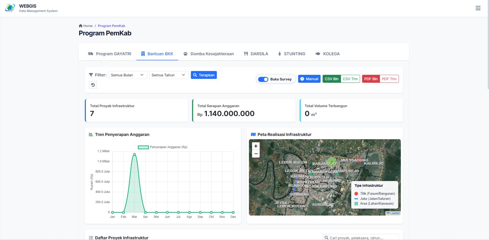
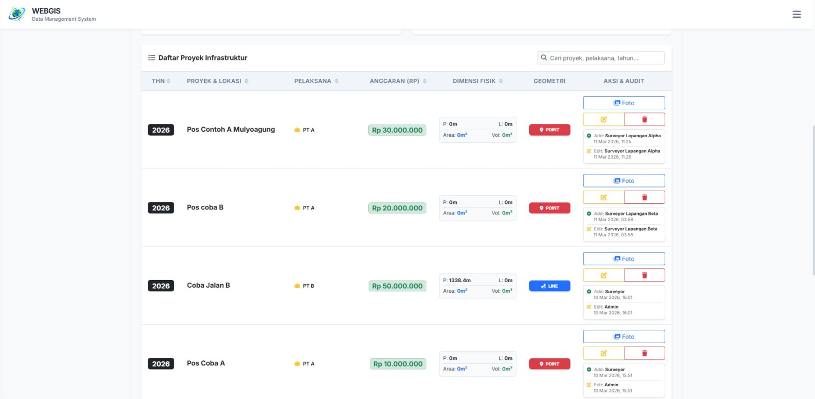
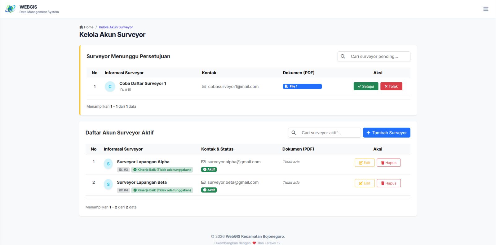
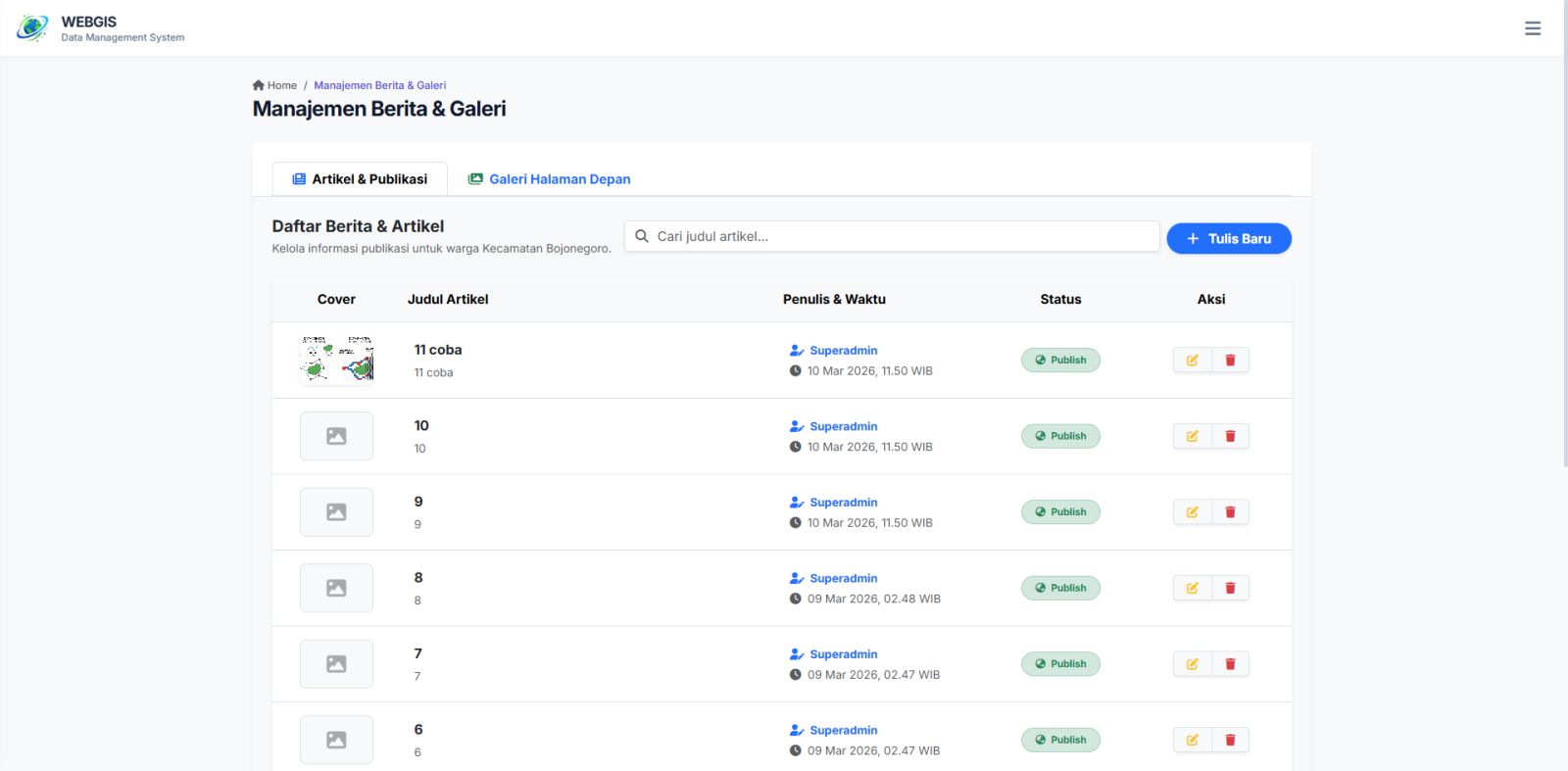
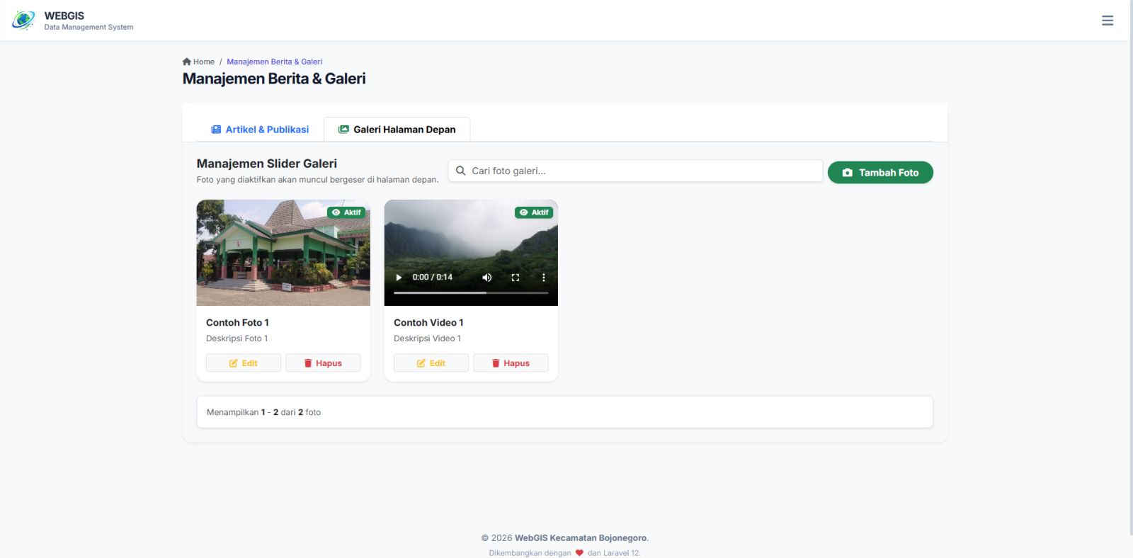
Enterprise-level GIS with a case study in Bojonegoro Sub-district, integrating local government programs (GAYATRI & BKK). 4 additional modules are coming soon for future budget phases. If you need a highly customized system like this for your region, we are more than ready to build it for you! Sistem informasi geografis level Enterprise dengan studi kasus Kecamatan Bojonegoro, mengintegrasikan program PemKab (GAYATRI & BKK). Terdapat 4 pengembangan lanjutan yang coming soon pada tahap anggaran kedepan. Jika Anda membutuhkan sistem kustom serupa untuk wilayah Anda, kami sangat siap untuk mewujudkannya!
Open live demo
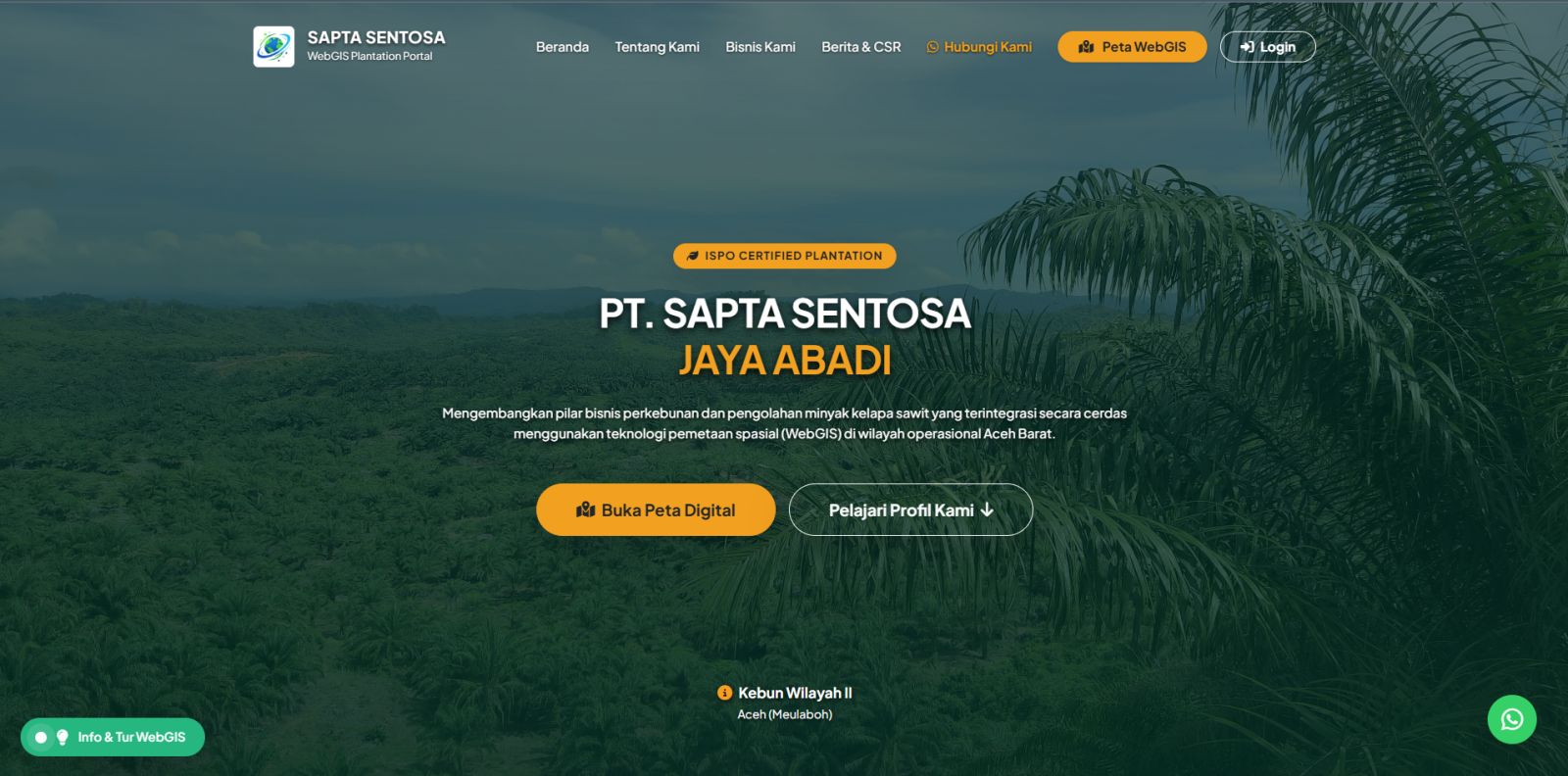
A comprehensive geospatial portal for plantation management. Featuring automatic GeoJSON import, multi-level user roles (Manager, Surveyor, Admin), dynamic attribute mapping, and integrated field documentation (Photos/PDF) per block. Portal geospasial komprehensif untuk manajemen perkebunan. Dilengkapi fitur import GeoJSON otomatis, hirarki akses (Manager, Surveyor, Admin), pemetaan atribut dinamis, serta integrasi dokumentasi lapangan (Foto/PDF) per blok lahan.
Open live demo

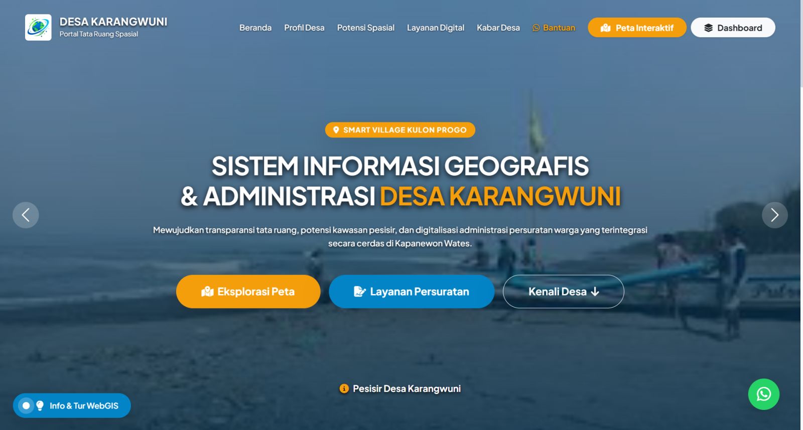
An integrated Smart Village platform combining spatial data management (land parcels, infrastructure) with a dynamic digital administration system for automated resident document/letter issuance. Platform Smart Village terintegrasi yang memadukan manajemen data informasi geospasial (persil tanah, infrastruktur) dengan sistem administrasi digital dinamis untuk otomatisasi penerbitan persuratan warga.
Open live demo
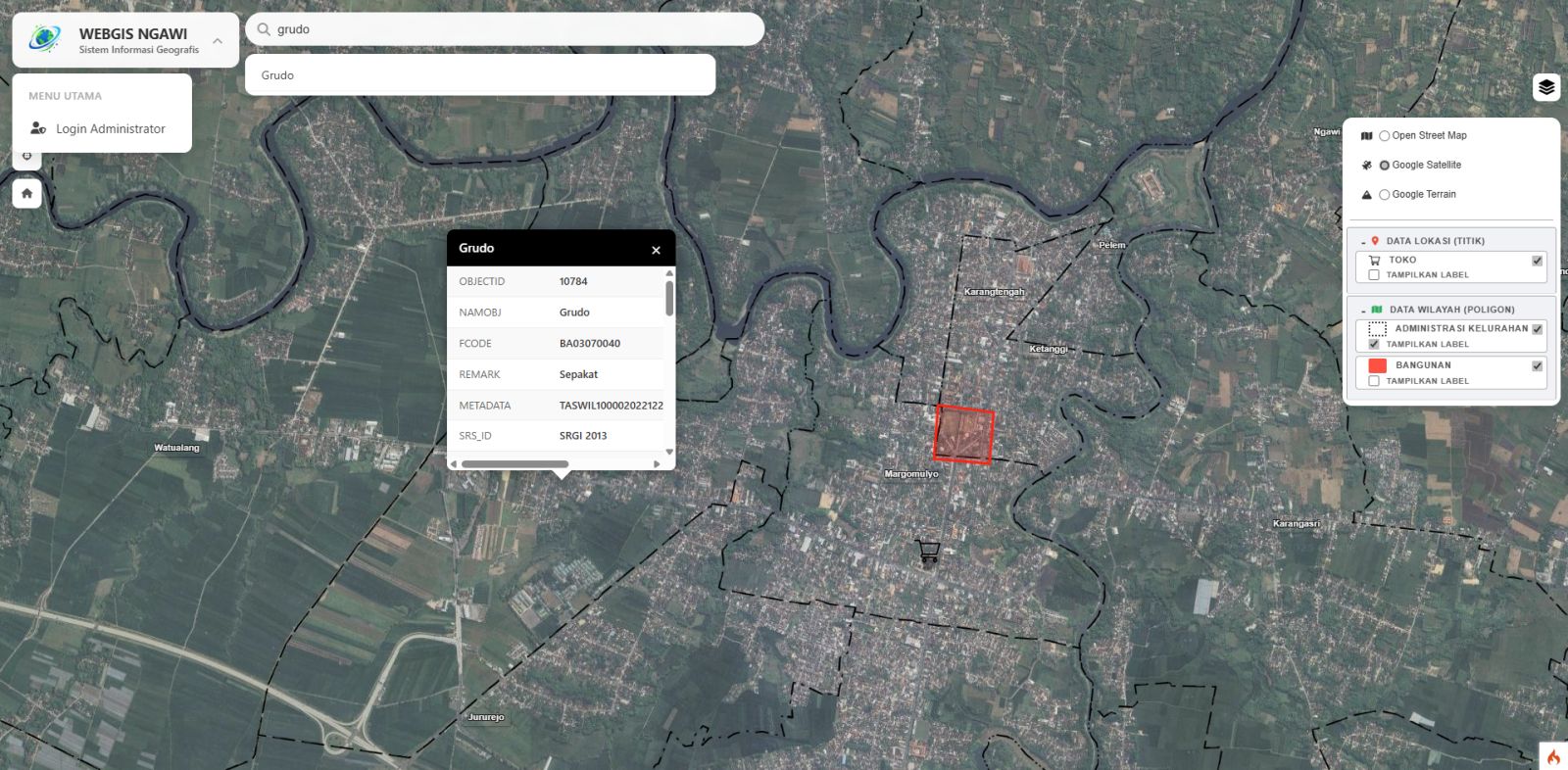
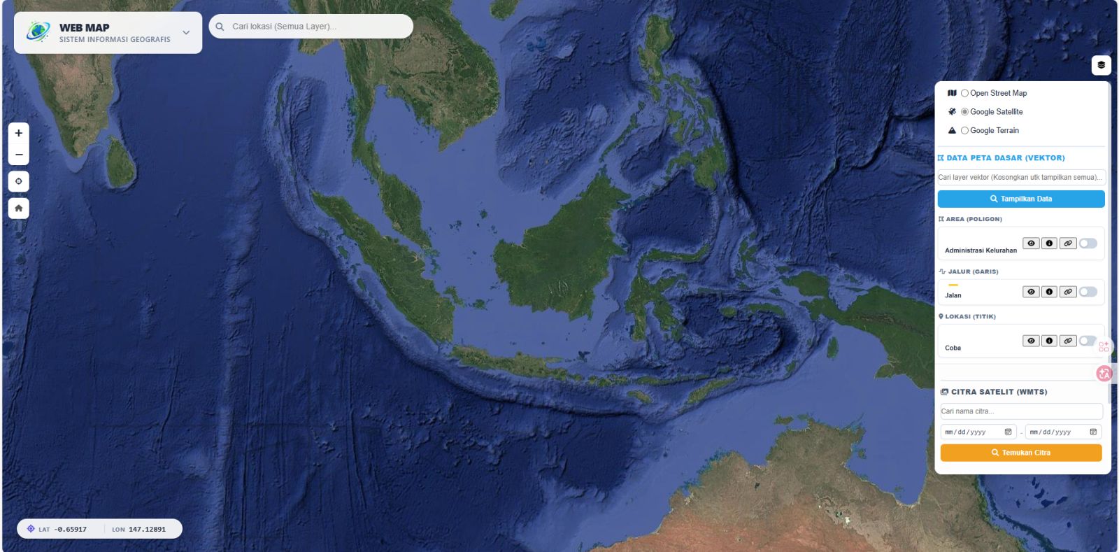
A highly lightweight interactive geographic information system. Click the image to play the video, or the title to read the case study. Sistem informasi geografis interaktif yang sangat ringan. Klik gambar untuk memutar video, atau klik judul untuk membaca studi kasusnya.
Open live demo
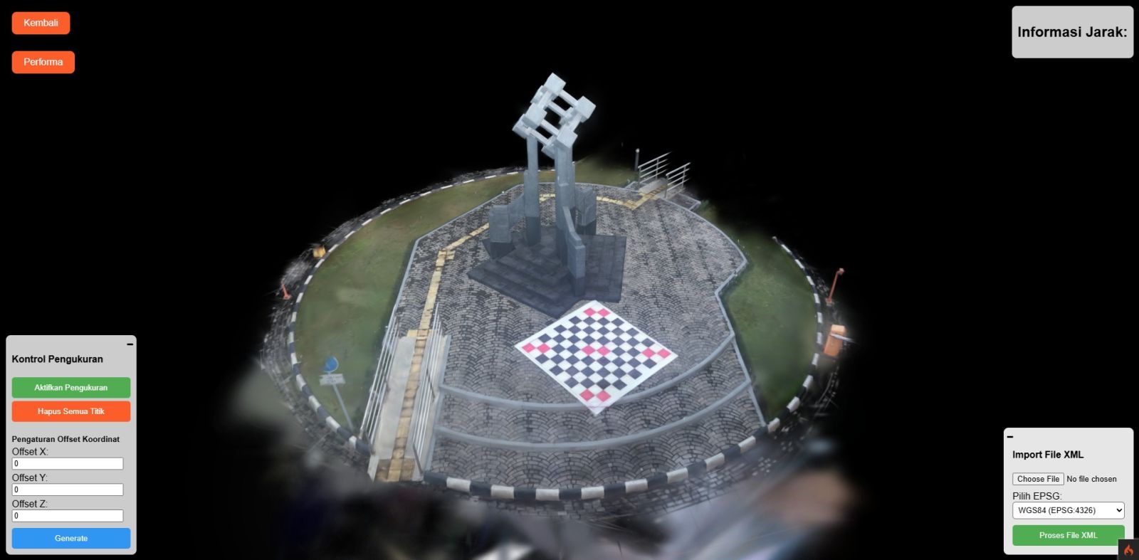
Cutting-edge rendering technology to display detailed geospatial objects. Click the image to open the system, or the title to read the case study. Teknologi rendering mutakhir untuk menampilkan detail objek geospasial. Klik gambar untuk membuka sistem, atau klik judul untuk membaca studi kasusnya.

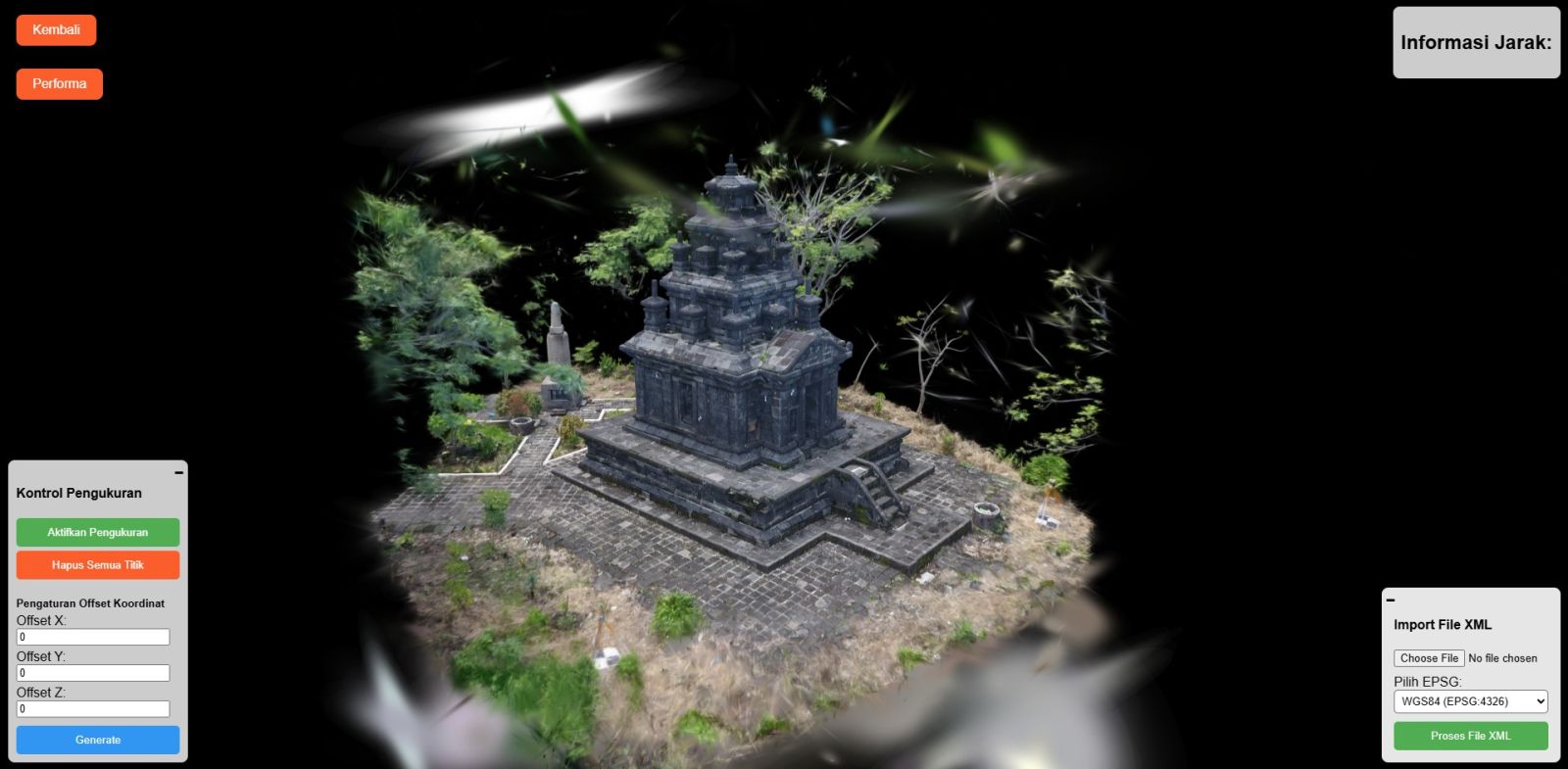
Detailed 3D Gaussian Splatting of Candi Tugu historical site. Click the image to open the system, or the title to read the case study. Pemodelan 3D Gaussian Splatting detail pada situs bersejarah Candi Tugu. Klik gambar untuk membuka sistem, atau klik judul untuk membaca studi kasusnya.

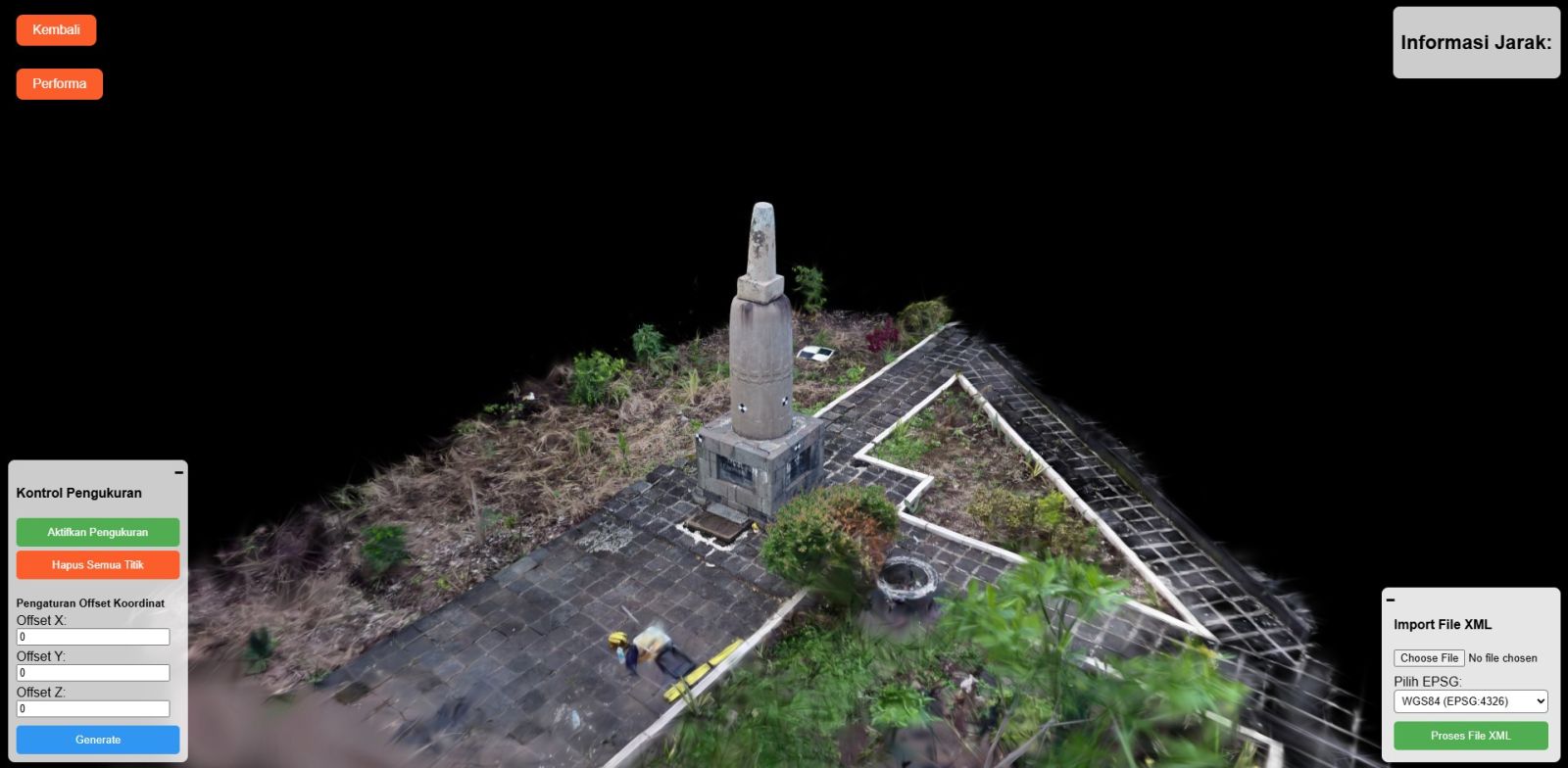
High-fidelity 3D visualization of Watu Tugu, Semarang. Click the image to open the system, or the title to read the case study. Visualisasi 3D fidelitas tinggi dari situs Watu Tugu, Semarang. Klik gambar untuk membuka sistem, atau klik judul untuk membaca studi kasusnya.

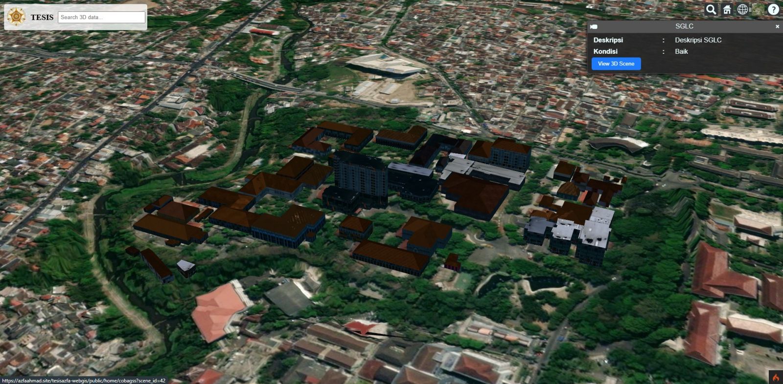
3D topography and building visualization using self-hosted WebGL technology (independent of third-party providers). Visualisasi topografi dan bangunan 3D menggunakan teknologi WebGL self-hosted (tidak bergantung penyedia layanan pihak ketiga).
Open live demoFrom the field and raw data to maps, reports, or a web platform — every step transparent and documented. Dari lapangan, data mentah, sampai peta, laporan, atau platform web — setiap langkah transparan dan terdokumentasi.
Free. We understand your question, existing data, required outputs, and deadline — then send a proposed method and quote. Gratis. Kami pahami pertanyaan, data yang ada, hasil yang dibutuhkan, dan tenggat — lalu kirim usulan metode serta penawaran.
Field surveys with partners, satellite imagery, or your own data — cleaned, harmonised in coordinates, and quality-checked. Survei lapangan bersama mitra, citra satelit, atau data Anda sendiri — dibersihkan, diseragamkan koordinatnya, dan diperiksa mutunya.
Spatial analysis, remote sensing, 3D modelling, or system development — with documented, repeatable methods. Analisis spasial, penginderaan jauh, pemodelan 3D, atau pengembangan sistem — dengan metode yang terdokumentasi dan bisa diulang.
Ready-to-use maps, datasets, reports, or WebGIS/geoportal/digital twin — complete with training and support. Peta, dataset, laporan, atau WebGIS/geoportal/digital twin yang siap pakai — lengkap dengan pelatihan dan pendampingan.
Packages for building WebGIS, geoportals, and digital twins. Analysis, data processing, imagery, and surveys are quoted per scope of work — estimates are free. Paket pembangunan WebGIS, geoportal, dan digital twin. Untuk analisis, pengolahan data, citra satelit, dan survei, biaya dihitung per lingkup pekerjaan — estimasinya gratis.
Starting Price (Base System)
Tailored to your scale & needs
Lihat rincian paket & apa yang termasuk → See full package details & what is included →
Analysis, data processing, satellite imagery, surveys, WebGIS, or a full project — tell us what you need and we reply with a proposed method, timeline, and cost. Analisis, olah data, citra satelit, survei, WebGIS, atau satu proyek penuh — ceritakan kebutuhan Anda, kami balas dengan usulan metode, waktu, dan biaya.
⚡ Fastest Response: ⚡ Respon Tercepat: